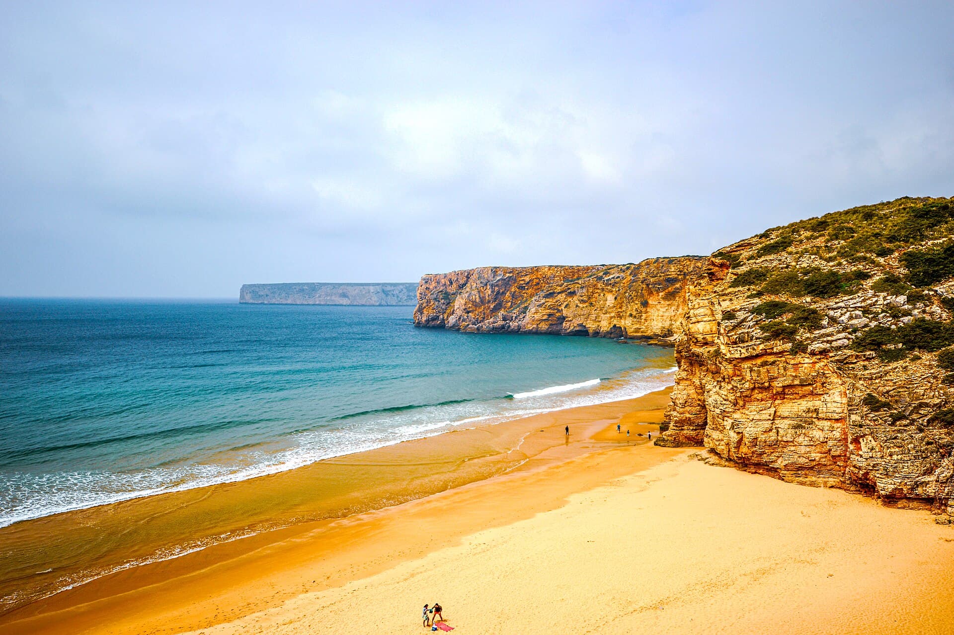
Praia do Beliche
WORTH A DETOUR

Portugal · Sagres

Praia do Beliche

The last south-facing beach before the Algarve runs out.

How we rated it: up one as the most westerly south-facing beach on the Algarve. The currents are in the catch. Photo: Michael Gaylard · CC BY 2.0

The hang

Visit Portugal calls Beliche the most westerly of the south-facing beaches on the Algarve. It is signposted off the N268 between Sagres and Cabo de São Vicente, at the bottom of a concrete staircase of about 100 steps, with a free car park of around 20 spaces at the top. The guide says it is rarely crowded: the descent and the lack of facilities keep casual visitors away. It also says that outside calm summer days with lifeguards present, you should treat it as a surf beach with strong currents. Quiet, a hundred steps down, and not as gentle as it looks.
The real intel

Best months · warmest sea
August (18.5 °C), then July and June. One year of data, 2025.
Best months · emptiest
No crowd data by month. The guide's word for it all year is rarely crowded.
Getting there
Signposted off the N268 between Sagres and Cabo de São Vicente.
Cost reality
The clifftop car park is free. It holds around 20 cars.
The catch nobody tells you
Outside calm summer days with lifeguards present, treat it as a surf beach with strong currents.

The year at Praia do Beliche

August: the warmest sea and the fewest wet days. Book that.

J
F
M
A
M
J
J
A
S
O
N
D
Sea (°C)
16.6
15.4
15.7
16.4
16.9
17.5
17.8
18.5
16.1
18.3
17.9
16
Air (°C)
14.4
13.7
13.9
16.1
17.8
20.7
21.1
22
19.7
19.9
15.9
13.6
Sun (h/day)
7.6
9
9.9
11.3
13
13.7
13.5
12.7
11.1
9.8
8.1
7.5
Rain (days)
14
8
18
19
6
2
1
0
2
7
10
15

One year of data, 2025, from Open-Meteo at this beach's coordinates. A rain day is 1 mm or more. The red bar is the month to aim for in each row.


The neighbours

6 beaches within 6 km, as the gull flies.

  1. 2.6 kmPraia do Telheiro261 m of beach, measured. Not rated yet.
  2. 3.2 kmPraia da Mareta745 m of beach, measured. Not rated yet.
  3. 3.4 kmPraia da Baleeira117 m of beach, measured. Not rated yet.
  4. 3.5 kmPraia do Martinhal702 m of beach, measured. Not rated yet.
  5. 4.0 kmPraia dos Rebolinhos102 m of beach, measured. Not rated yet.
  6. 4.7 kmPraia da Ponta Ruiva509 m of beach, measured. Not rated yet.

Straight-line distances from the mapped beach shapes (OpenStreetMap). Roads are longer, and in Bali they are much longer.


The crowd

Rarely crowded. The 100-step descent and the lack of facilities keep casual visitors away.


The receipts

A seasonal bar at the clifftop serves drinks, snacks and basic meals, roughly May to September.


The facts · we measured

Length
380 m
Mean width
39.6 m
Area
15,076 m²
Warmest sea (2025)
18.5 °C in Aug
Coldest sea (2025)
15.4 °C in Feb
Sea by month, °C
Jan 16.6 · Feb 15.4 · Mar 15.7 · Apr 16.4 · May 16.9 · Jun 17.5 · Jul 17.8 · Aug 18.5 · Sep 16.1 · Oct 18.3 · Nov 17.9 · Dec 16.0

Questions people ask

Where is Praia do Beliche?

It is signposted off the N268 between Sagres and Cabo de São Vicente, and Visit Portugal calls it the most westerly of the south-facing beaches on the Algarve.

Is Praia do Beliche safe for swimming?

Outside calm summer days with lifeguards present, the guide says to treat it as a surf beach with strong currents.

Is there parking at Praia do Beliche?

A small free car park of around 20 spaces at the clifftop, with a concrete staircase of approximately 100 steps down to the sand.