The vibe
Hidden beaches
The ones that make you work for it — stairs, hikes, tunnels, and the blessed absence of a beach club.
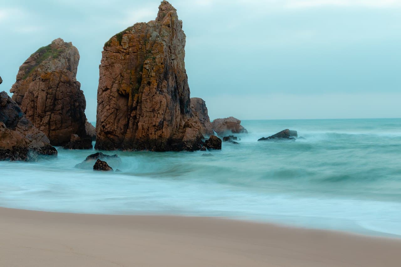
Portugal · Sintra Coast
No. 2
Praia da Ursa
Book the flight now.
Marinha's wilder, uglier, more committed sister. You get there via a dirt path and a rope-assisted scramble down a cliff that redefines "beach access." The reward: a raw, unmanaged cove with sea stacks that look like gods left their chess game half-finished. No sunbeds. No snack bar. No lifeguard. No pretense. This is what every Algarve beach looked like before someone built a road to it.
Best: May–Jun, Sept–Oct →
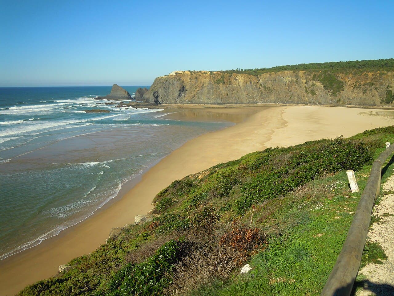
Portugal · The Algarve
No. 12
Praia de Odeceixe
Worth a detour.
The last beach in the Algarve before you tip into the Alentejo, and the one that resets your standards. A river meets the sea here — you can swim in the warm creek with toddlers on one side, or brave the cold Atlantic on the other, separated by 50 meters of sand. The village behind it is a single street of white houses with a windmill. It's what the Algarve was before the budget airlines. Come here to remember.
Best: June–Sept →
No photo we can show yet
Indonesia · Bali
Nunggalan Beach
A twenty-minute walk to a shipwreck and nobody.
Nunggalan takes about 20 minutes to walk down to and about 30 to walk back up from. At the bottom there is a long stretch of golden sand, an old shipwreck rusting into it, and almost no one else. There are no vendors and no beach clubs. The waves are often strong, and the emptiness that makes the beach is also the reason to be careful in the water: few people will be around if there is trouble. It also goes by Shipwreck Beach and Secret Beach.
Best: March (29.9 °C), then December and April →
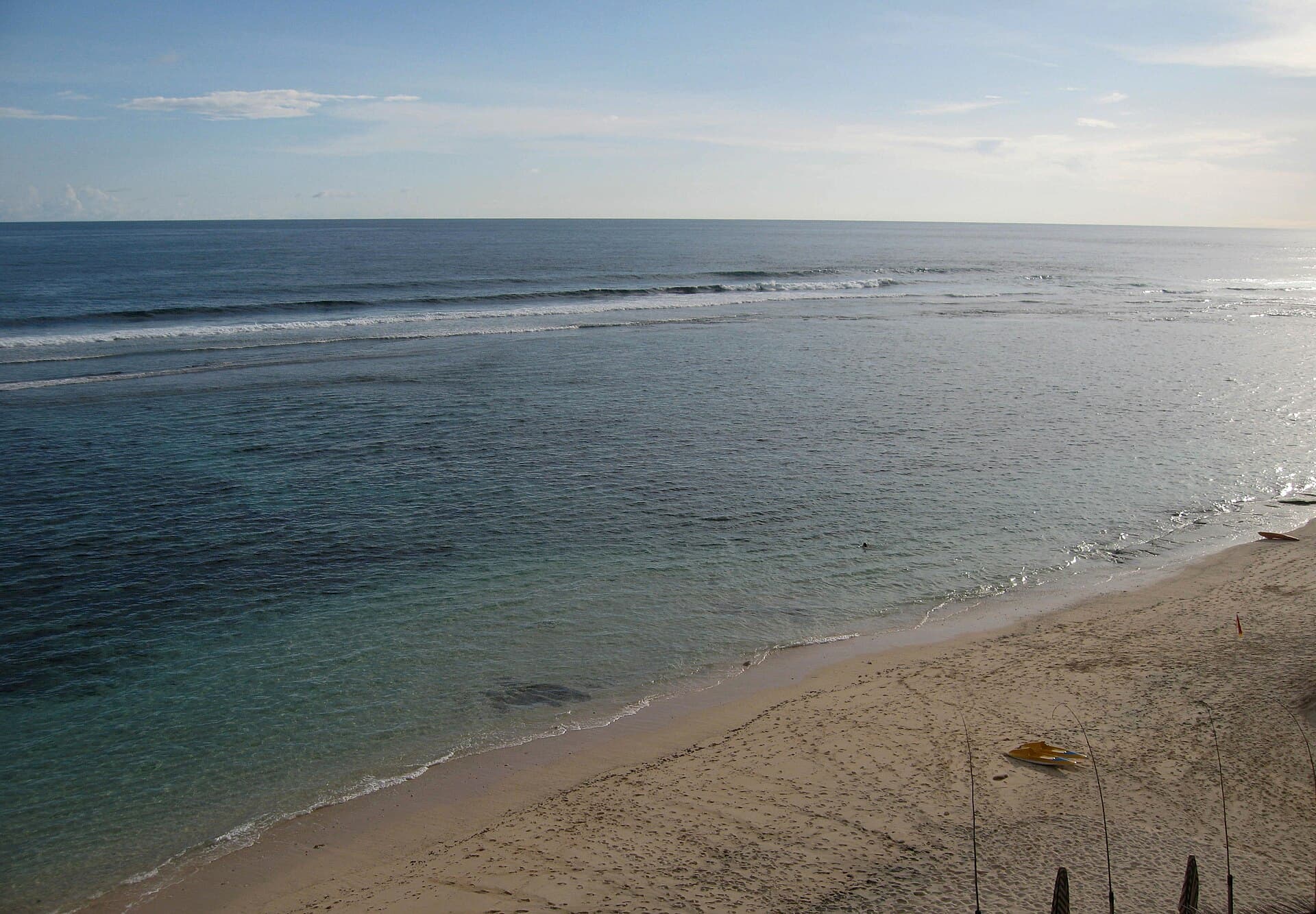
Indonesia · Bali
Nyang Nyang Beach
More than 500 steps down, and the same back.
The way to Nyang Nyang is a long staircase of more than 500 steps, down through green hills and rice terraces from a small parking area near Uluwatu. Crowds are low all year. There are no toilets, food stalls or shops on the beach, so what you carry down is what you have. The waves are powerful and there are no lifeguards. We measured 1.3 km of sand, which is a lot of beach per person.
Best: March (29.9 °C), then December and April →
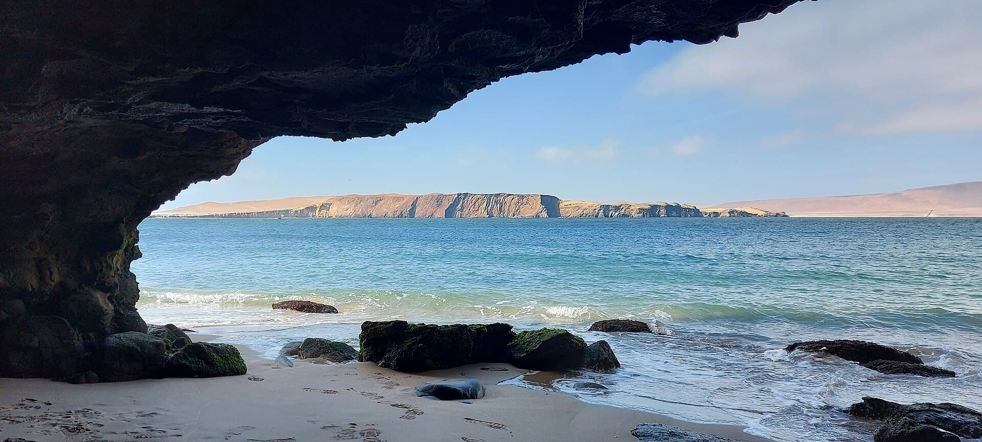
Peru · Paracas, Ica
No. 2
La Mina Beach
187 metres of sand inside a national reserve, guarded by cliffs.
La Mina is the shortest of Peru's ten, 187 metres by our measurement, in the Paracas National Reserve in the Ica region. Cliffs guard it from the open sea. You pay the reserve's entrance fee to reach it. The guide's packing list: a windbreaker, sunscreen and proper water shoes.
Best: February (18.9 °C), then March and April →
No photo we can show yet
Peru · Piura
No. 6
Playa Pocitas
Long, thin, rocky, and quiet because it is hard to reach.
Pocitas is 3,328 metres long and 44 metres wide on average by our measurement, the most stretched-out shape of Peru's ten: about 75 times longer than it is wide. The way down is a set of stairs one visitor calls dangerous, then forgets about. On the sand are beachfront rooms and restaurants, with toilets and loungers at some bars if you order.
Best: March (27.7 °C), then February and April →
Peru · Tumbes
No. 9
Playa Punta Sal
Walk half an hour past the resorts and the beach empties out.
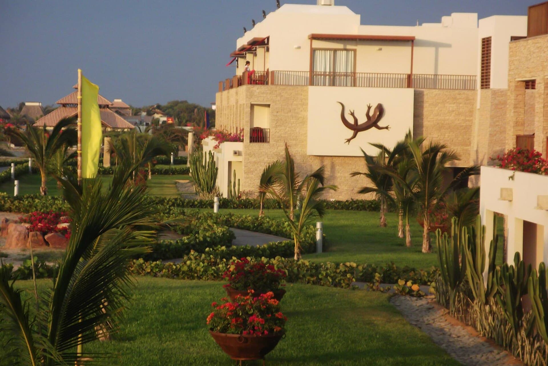
Punta Sal is 1,533 metres of sand by our measurement, with resorts and holiday homes along it. You come in through a security checkpoint off the Pan-American Highway, and the sand stays open to everyone: one guide notes that it is against the law in Peru to block access to the water. Walk about 30 minutes past the resorts and you reach wide stretches with very few people. Its sea was the warmest of the ten in 2025.
Best: March (28.1 °C), then February and April →
Peru · Piura
No. 10
Playa Lobitos
A ghost town at the westernmost point of continental South America, with surf.
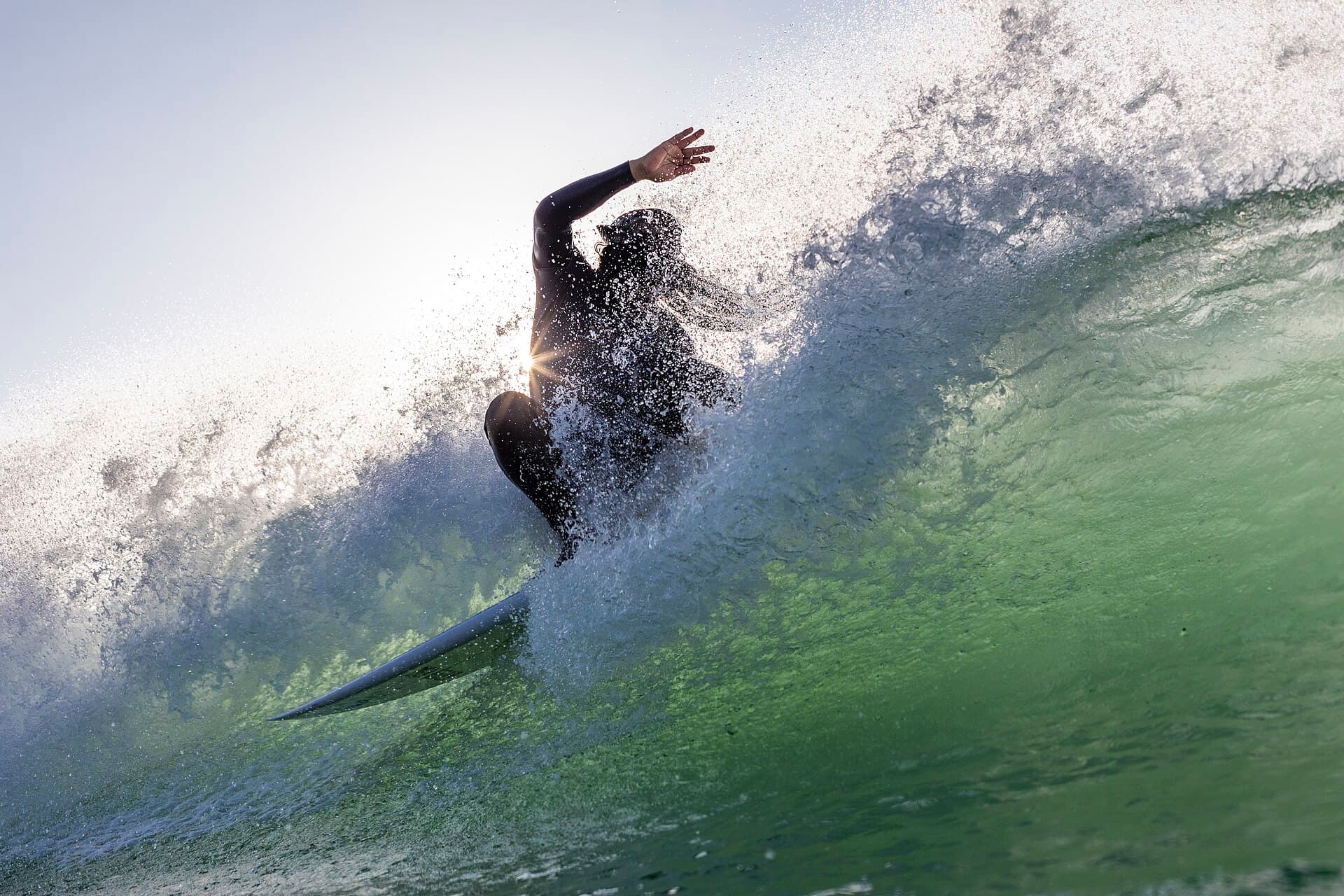
Lobitos is a former port and military base on the coast not far from the Ecuadorian border, now often called a ghost town for its abandoned buildings. Lonely Planet calls it a hub for perfect waves at the westernmost point of continental South America. Most streets have no names, so drivers find your room by its name. The main break gets crowded when the swell is below about two metres; the two other points nearby are much quieter.
Best: February (26.8 °C), then March and April →
Italy · Baunei, Sardinia
No. 1
Cala Goloritzé
A landslide made it in 1962. Now you need an app to get in.
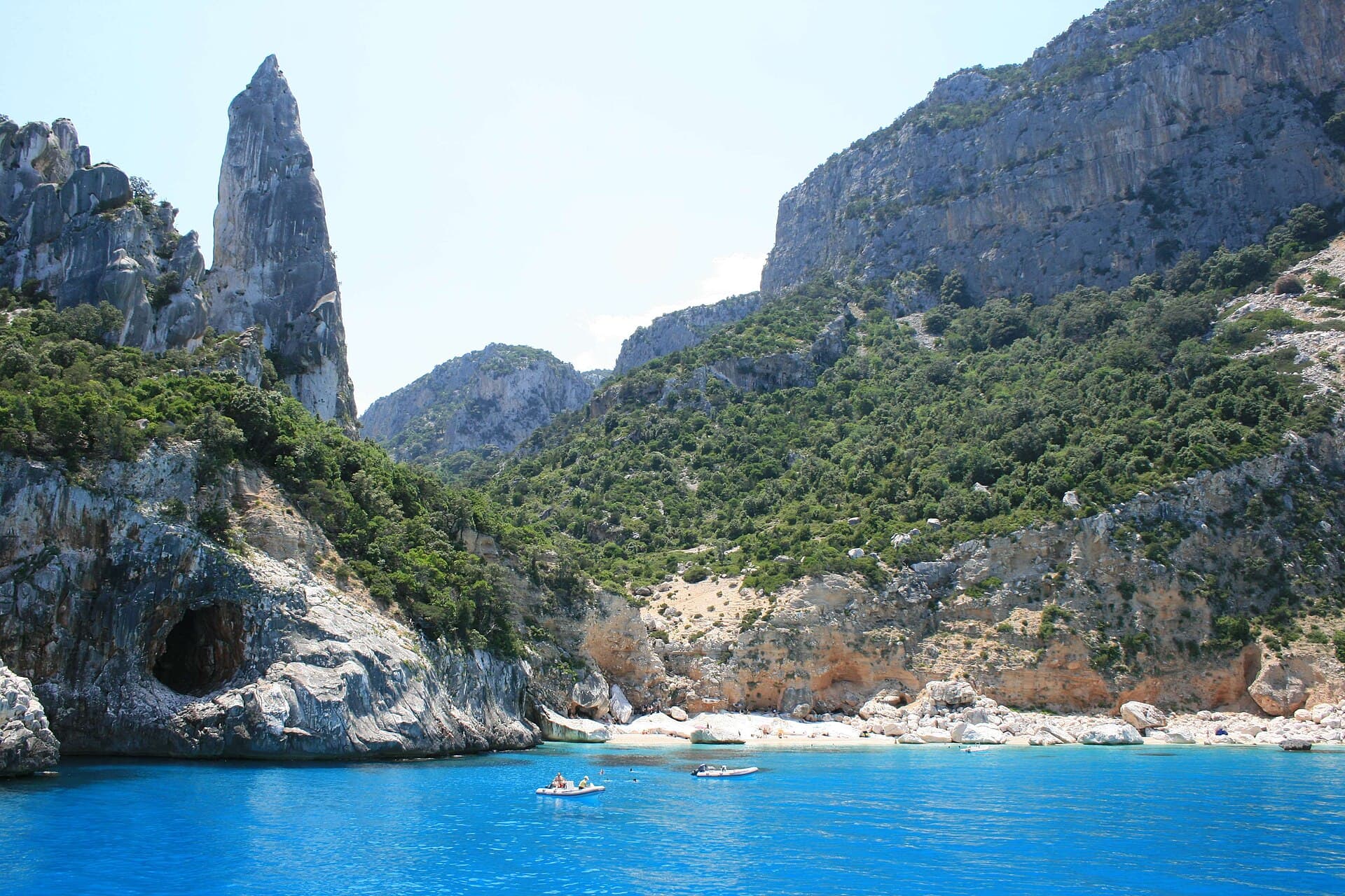
Cala Goloritzé was created by a landslide in 1962, at the base of a ravine on Sardinia's eastern coast. Three of the four lists we read name it, and one calls it the most beautiful beach in Italy. You reach it on foot, from the Su Porteddu car park on the Golgo plateau: about 3.5 km and 500 metres down, an hour and a half in and two hours back. Boats cannot land you (a 2026 guide says motorboats may not moor within 300 metres) and you may not leave by boat. In 2026 you book in the Heart of Sardinia app and pay €7, by the official Baunei tourism site; one guide puts the limit at 250 people on the beach at once. Wikipedia says 800 would come on a peak-season day if they could.
Best: August (27.6 °C), then July and September →
Italy · Liguria
No. 5
San Fruttuoso
No road goes here. Everyone comes anyway, by boat.
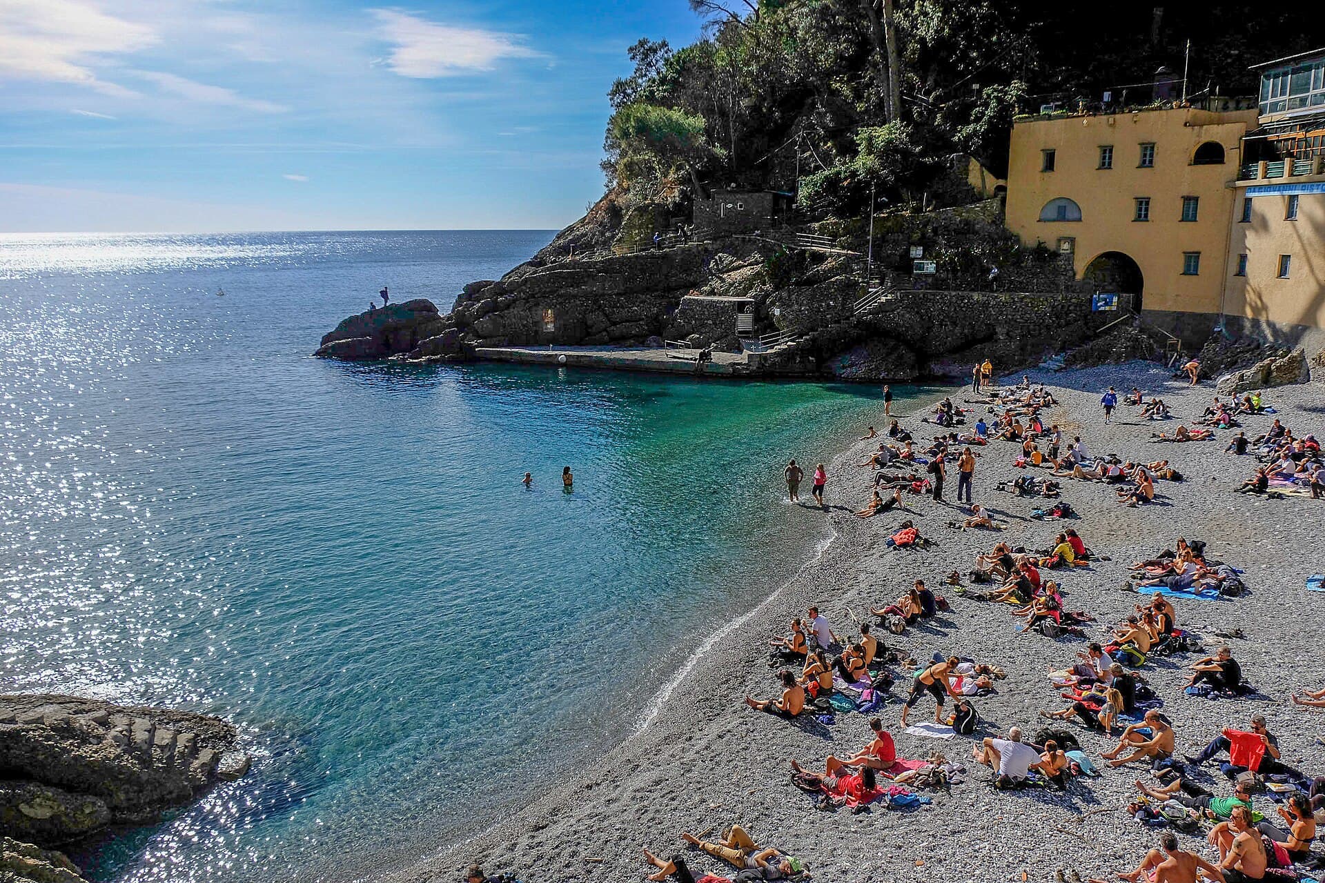
San Fruttuoso has no road. You get there by hiking the steep wooded trails from Portofino, or by ferry or private boat from Rapallo or Camogli. Lonely Planet calls it the best beach for scuba divers and wildly popular, which is quite a combination for a cove we measured at 64 metres. Near the beach are a basic cafe and a couple of restaurants.
Best: July and August (26.5 °C each), then June →
Thailand · Ko Pha Ngan
No. 2
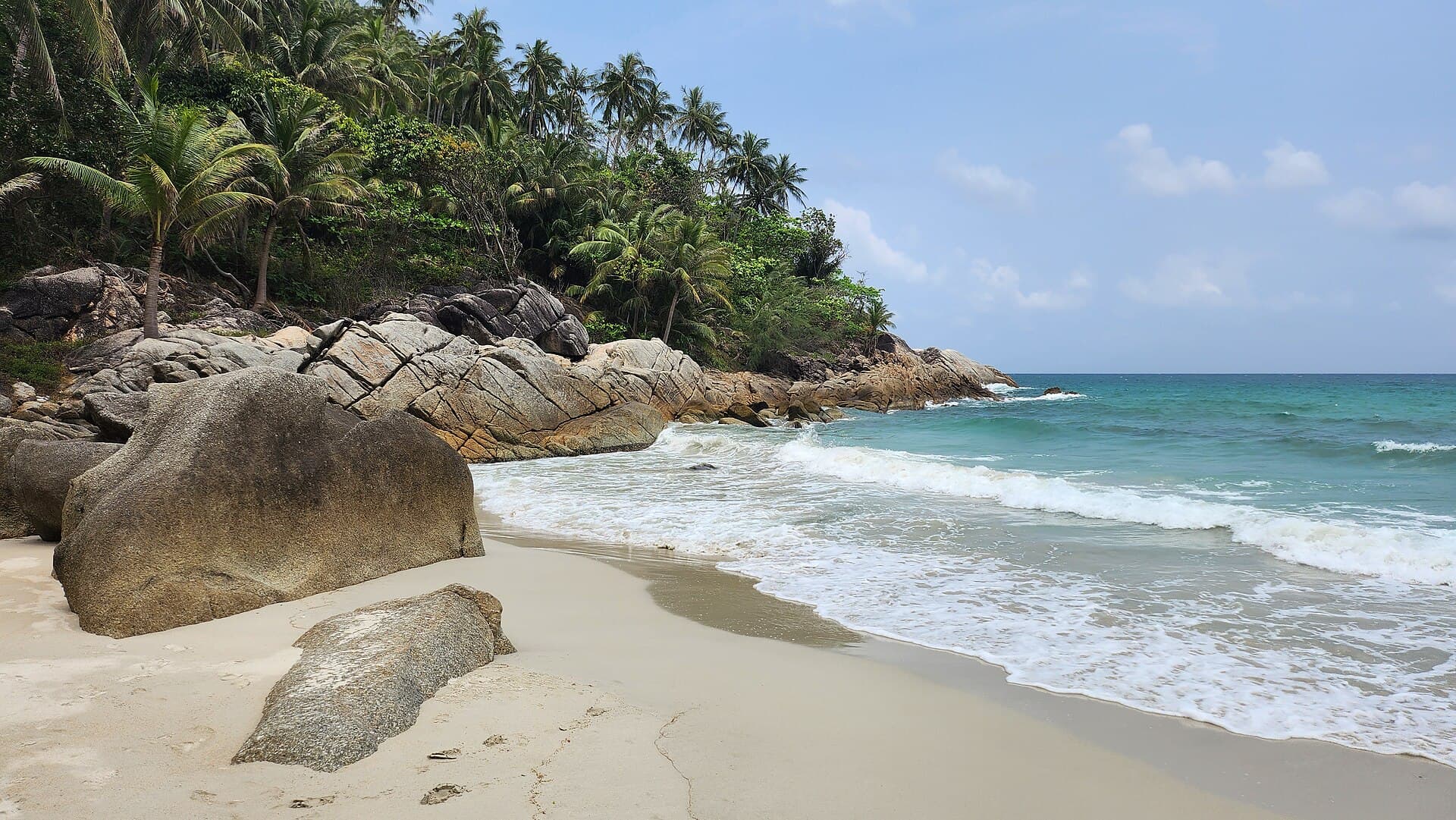
Bottle Beach
A longtail or a 90-minute jungle trail. After the last boat, it is yours.
Bottle Beach, Hat Khuat, has no road. You arrive by longtail from Chaloklum, about 15 minutes and 100 to 150 baht a head, or on foot along a jungle trail of 60 to 90 minutes. The boats depend on the sea and can stop in rough weather. There are a few simple bungalow operations and beach restaurants, and little else, so bring cash. Day-trippers see a busy beach; anyone who stays the night has it near enough to themselves once the boats have gone. We measured 518 metres of sand.
Best: May (31.3 °C), then April and June →
No photo we can show yet
Thailand · Phuket
No. 4
Freedom Beach
Closed after its third drowning in 15 months. When it reopens, mind the flags.
Freedom Beach is a cove south of Patong. By land, entry is 100 baht a head, then a long jungle path and stairs down to the sand; the climb back up in the afternoon heat is what reviewers grumble about, and a shuttle truck at the top charges another 100. By sea it is a 10 to 20 minute boat ride from the south end of Patong, and with no dock you jump into the water and wade in. Part of the bay is roped off for boats, so the swimming area is smaller than it looks. It fills around midday, even on weekdays.
Best: April (30.5 °C), then May and March →
Thailand · Ko Phi Phi Leh
No. 5
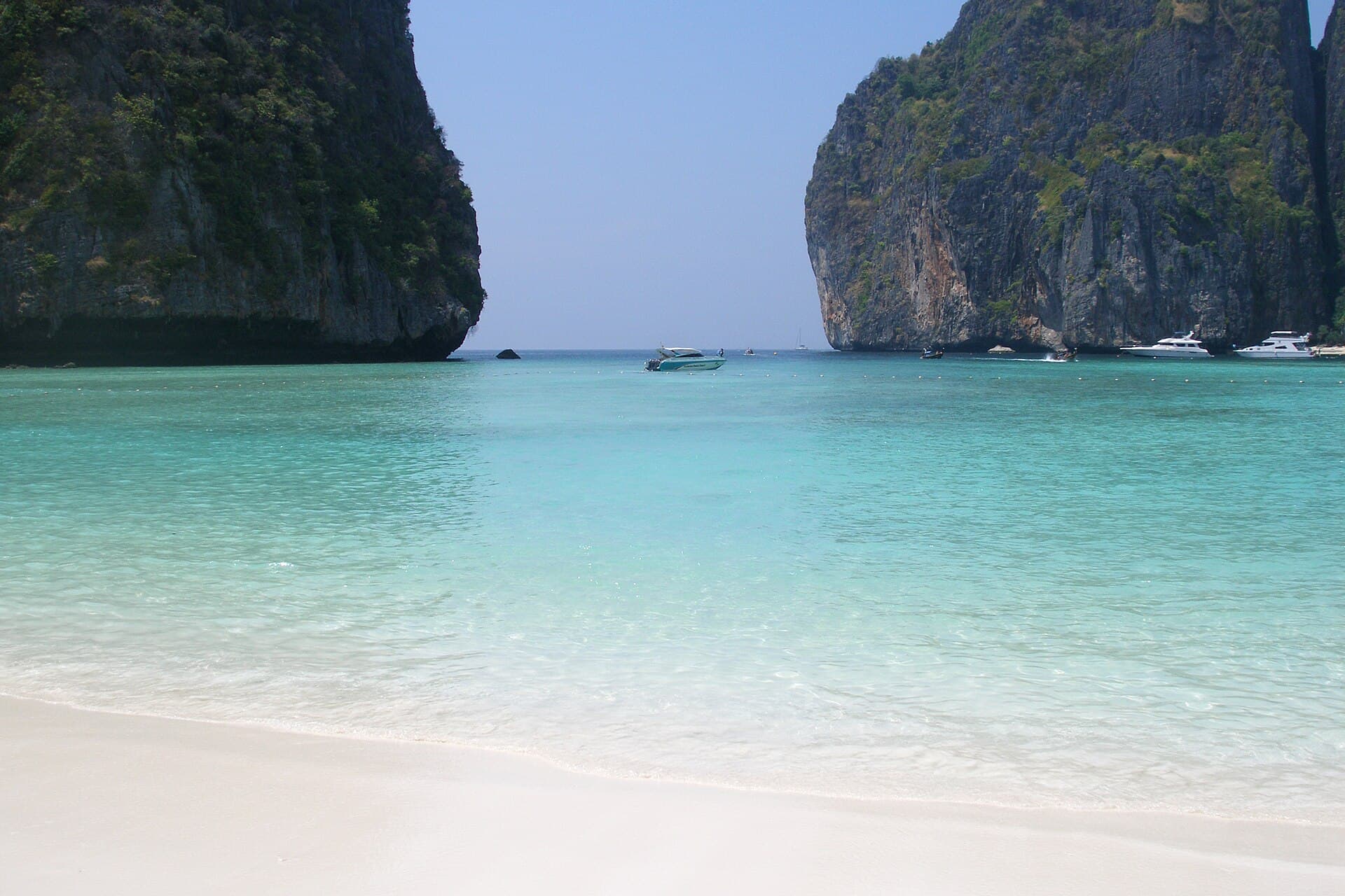
Maya Bay
You may look at the water. Rangers make sure you do not swim in it.
Maya Bay is on Phi Phi Leh, where nobody stays, so every visit is a day trip from Phi Phi Don, Phuket or Krabi. Boats dock at Loh Samah Bay on the other side of the headland and walk you in on a boardwalk. Swimming inside the bay is banned, full stop, and rangers enforce it. The bay closes completely from 1 August to 30 September to let the reef recover, reopening on 1 October, and runs from 7am to 6pm the rest of the year. Entry is in the 400 baht Mu Ko Phi Phi park fee, which tours may already include.
Best: April (30.6 °C), then May and August →
Thailand · Similan Islands
No. 6
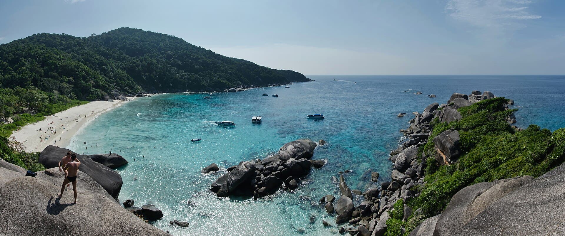
Donald Duck Bay
One hour on the sand, shared with several other boats, half the year.
Donald Duck Bay, Ao Kueak, is in the Similan Islands National Park, reachable only on park day trips and liveaboards from Khao Lak and Phuket, and only in season: the park closes from mid-May to mid-October to protect the reef and avoid rough seas. Most tours leave from Thap Lamu Pier near Khao Lak. The park fee is THB 500 an adult and THB 250 a child. On the trip one guide describes, visitors had one hour on the beach and shared it with several other boats. The World's 50 Best Beaches put it tenth in 2026.
Best: April (30.3 °C), then May and March →
No photo we can show yet
Thailand · Ko Lipe
No. 7
Sunset Beach (Ko Lipe)
Quiet all day, then the whole island turns up at six.
Sunset Beach faces directly west, which makes it one of Ko Lipe's favourite places to watch the sun go down. It is quieter than the rest of the island until then, when the crowds come from everywhere. It is rockier and more rugged than Sunrise Beach; we measured 360 metres of it. You can walk from Walking Street, on a path that can be uneven, or take a motorbike taxi for a flat 50 baht. A few beach bars and bungalow resorts line it. Outside November to April the island effectively closes.
Best: August (31.1 °C), then July and May →
Spain · Cabo de Gata, Almería
No. 5
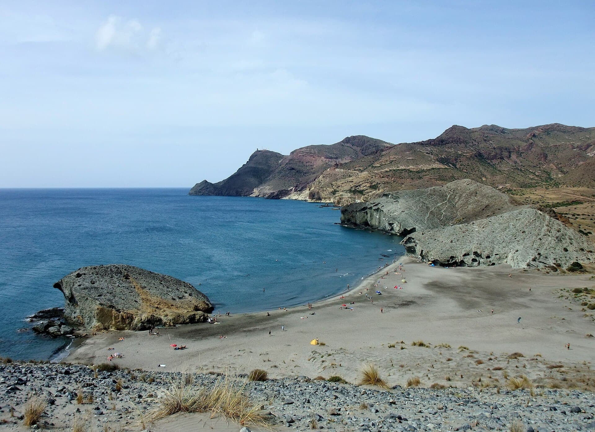
Playa de Mónsul
Indiana Jones was here. The car park was not built for the rest of us.
Mónsul is in the Cabo de Gata Natural Park, 45 minutes' drive from Almería airport, and it was the backdrop for some scenes in Indiana Jones and the Last Crusade. You reach it on a four-kilometre dirt road, and parking is limited. Being inside a natural park, it has no man-made facilities at all. We measured 459 metres of sand.
Best: August (26.3 °C), then July and September →
Spain · Fuerteventura
No. 8
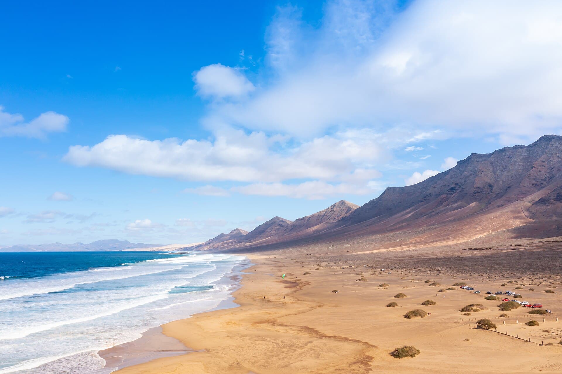
Playa de Cofete
An hour of gravel road to one of the Canaries' great unspoilt beaches.
Cofete is on Fuerteventura's wild side, at the end of about an hour's drive on a narrow, winding, very bumpy gravel road to Cofete village; without a car there is an infrequent bus on the same road. One guide calls it one of the most famous unspoilt beaches in the Canary Islands. The polygon we measured is 6,266 metres long and 157 wide on average, among the biggest in our survey of Spain.
Best: August and September (23.1 °C each), then October →
Mexico · Tulum
No. 2
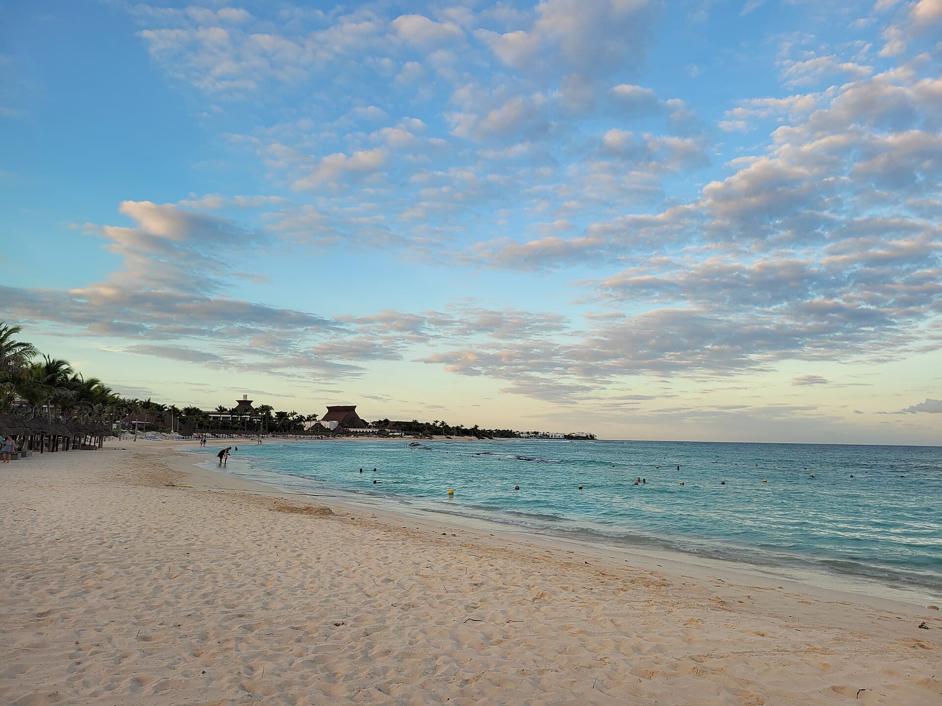
Playa Paraíso
Ruins on the cliff, a hard closing time, and not a swim beach.
Playa Paraíso is the beach below the ruins at Tulum. One 2026 guide says you reach it only through the archaeological zone, with its ticket; two others say there is no fee, and we print both. It opens daily from 8am to 5pm, with a hard closing time; arrive at 8 to walk the cliff path before the day-trippers. There are changing rooms and a beach club with cold drinks. The same guide calls it not a swim beach: rip currents and unpredictable waves make it unsuitable for young or inexperienced swimmers, and from May to October the sargassum can be severe.
Best: August (30.5 °C), then September and July →
Mexico · Quintana Roo
No. 3
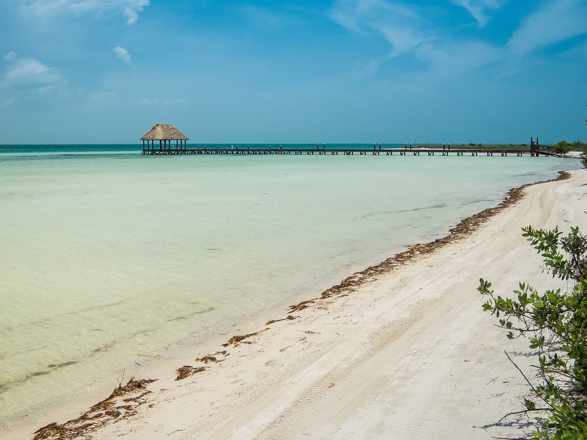
Isla Holbox
No cars allowed. A golf cart from the ferry, and sunset over the Gulf.
Holbox is an island, and cars are not allowed on it. The last leg is always the ferry from Chiquilá, about 30 minutes across; in high season ferries leave about every half hour from 6am to 9:30pm. From the dock, a golf-cart taxi to a beachfront hotel cost one traveller 100 pesos in 2023. The beach has plenty of restaurants and bars for watching the sunset over the Gulf of Mexico. The beach polygon we measured, mapped as Punta Cocos and Bonita Playa, is 5.8 km long. On the walk out to Mosquito Point, get back to firm ground before high tide covers the sandbar.
Best: September (29.3 °C), then October and August →
Mexico · Oaxaca
No. 6
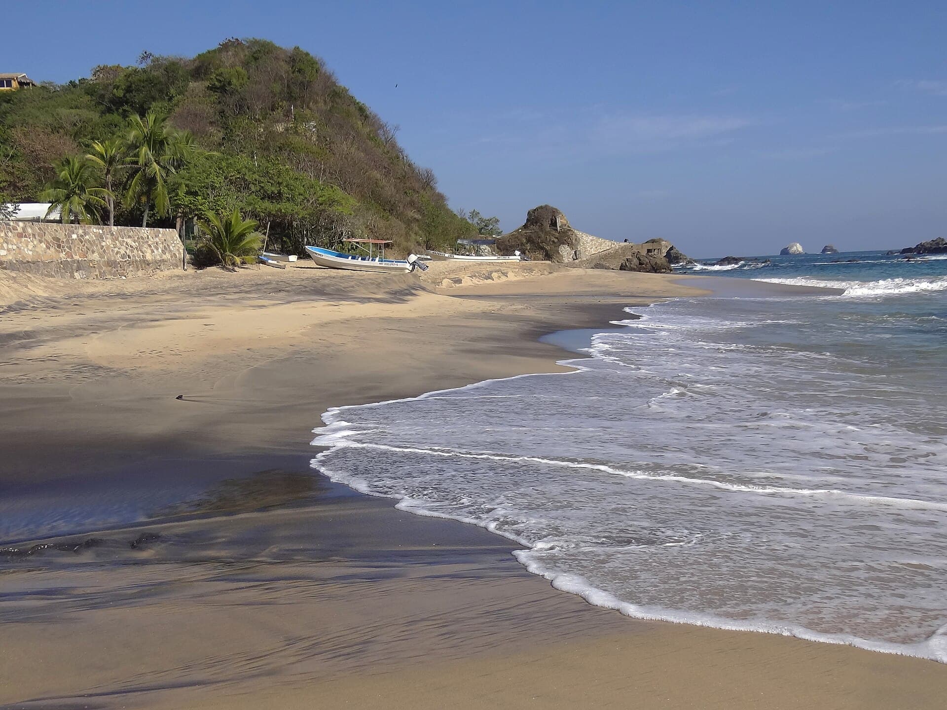
Playa Mazunte
Palm shade, simple restaurants, and a sea that keeps you honest.
Mazunte is a wide, open beach on the Oaxaca coast with palm trees for shade and a line of simple beachfront restaurants. You get there from Pochutla by taxi (about M$60), colectivo truck (M$15) or bus (M$10). Waves and currents can make it a tough place to swim, and currents are strong throughout the region, so watch the conditions. One visitor in April, the slow season, found the town quieter than usual. We measured 1,208 metres of sand.
Best: August (31.1 °C), then July and September →
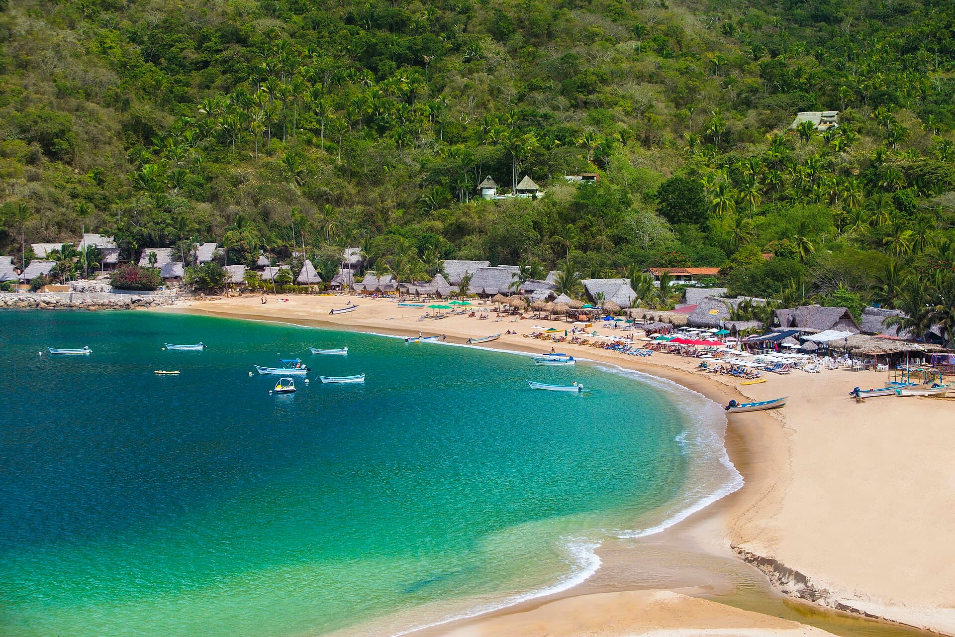
Mexico · near Puerto Vallarta, Jalisco
No. 8
Yelapa
No road. A 30-minute boat, fish tacos, and a return time to remember.
Yelapa has no road big enough for ordinary vehicles. The only way in is a water taxi, about 30 minutes from Puerto Vallarta or from Boca de Tomatlán. The beach is long and the tourists are sparse, in Condé Nast Traveler's words, and a thatched-roof beach bar, Angelina's Gardens Beach Club, serves fish tacos and beer. The water taxis keep set schedules, so confirm your ride back. We measured 519 metres of sand.
Best: September (31.1 °C), then July and August →
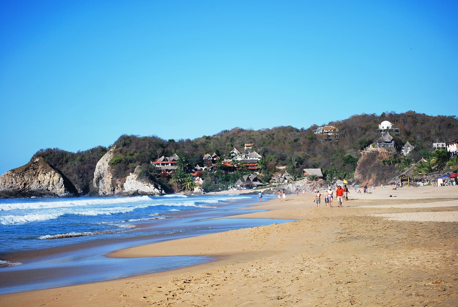
Mexico · Oaxaca
No. 10
Playa Zipolite
Locals call it the Beach of the Dead. The undertow is the reason.
Zipolite is on the Oaxaca coast, and locals call it the Beach of the Dead. Wikipedia says the waves are strong in the afternoon, the undertow is always strong, and people swim here but caution is strongly advised. A volunteer lifeguard team and a flag system show where and when it is safest. From the Pochutla bus turnoff a taxi is M$200, a shared taxi M$50, a colectivo M$20. ATMs are scarce and often empty. We measured 1,421 metres of sand.
Best: August (31.1 °C), then July and September →
No photo we can show yet
Croatia · Lubenice, Cres
No. 5
Sveti Ivan
An hour down a rocky path, and the same hour back up.
Sveti Ivan lies below the clifftop village of Lubenice on Cres. You reach it by boat or on foot: a steep, rocky descent of 40 minutes to an hour, depending on who is timing it, and then you hike back up the same way. There is nothing on the beach, so bring water and a towel. The effort keeps it uncrowded even in peak season. We measured 107 metres.
Best: July (24.7 °C), then August and September →
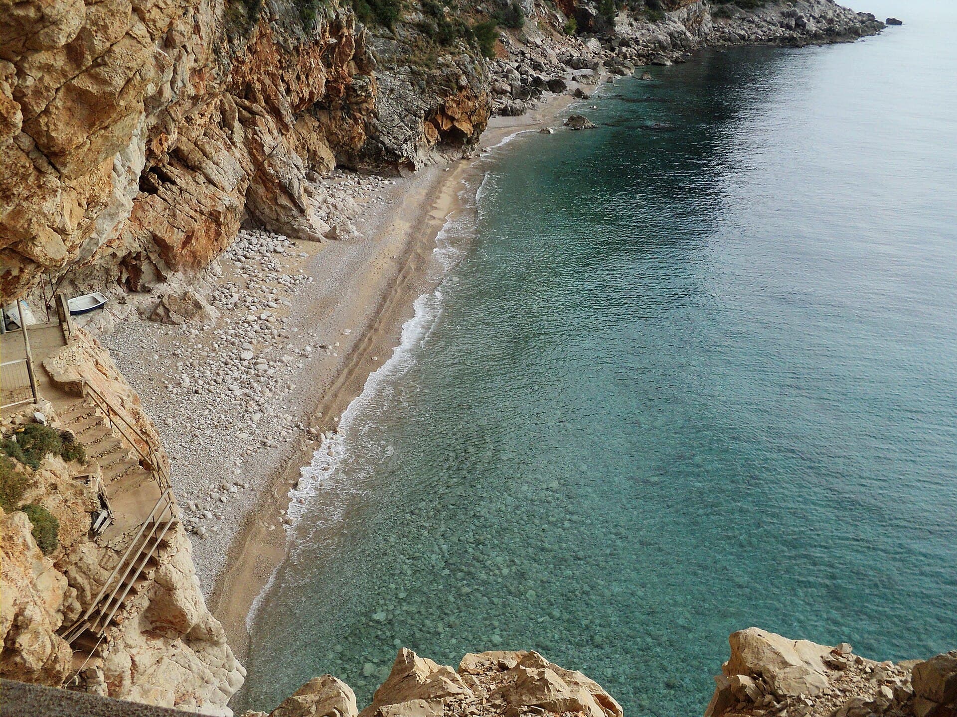
Croatia · Konavle
No. 7
Pasjača
Made from the rubble of a tunnel, thrown off a 200-metre cliff. Check the path before you go.
Pasjača exists because of a drainage tunnel: in the middle of the last century, the earth and stone dug out to drain the Konavle fields were thrown into the sea from the edge of a 200-metre cliff, and the waves turned them into a beach. In April 2025 a large rockfall buried the path down, and a regional paper reported the beach could be reached only by sea; a July 2026 article still advises checking whether the path is passable before you go. It is 40 minutes' drive south of Dubrovnik, at the village of Popovići, where an asphalt road from Cavtat ends in parking for about 50 cars. The way down is a steep, narrow, winding path and a small tunnel carved through the rock. Nothing is provided: bring water, a towel and a roll-up mat. Its remoteness keeps it quieter than most beaches nearby. We measured 91 metres; Wikipedia says 80.
Best: July and August (26.0 °C each), then September →
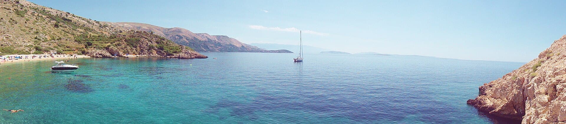
Croatia · Stara Baška, Krk
No. 8
Oprna
A short steep path, €30 loungers, and a bar in summer.
Oprna is a bay on Krk, about 2.6 km north-west of Stara Baška. You park above it and walk down a short but steep path, sturdy shoes advised, or arrive by boat. Entry is free; loungers and umbrellas run about €30 for the day, and there is a simple beach bar in summer. It is remote enough to stay quiet. We measured 134 metres.
Best: July (24.5 °C), then September and August →
No photo we can show yet
Croatia · Brač
No. 9
Murvica
Zlatni Rat's quiet neighbour: cliffs, vineyards and pines.
Murvica is a short drive west of Bol on Brač, down a short but steep descent, and far less busy than Zlatni Rat next door, in Vogue's words, with cliffs, vineyards and pines around it. Facilities are limited: a seasonal bar with ice cream and cold drinks, and a roadside shop whose hours one guide calls unreliable. Bring what you need. We measured 135 metres.
Best: July and August (25.7 °C each), then September →
Philippines · Palompon, Leyte
No. 2
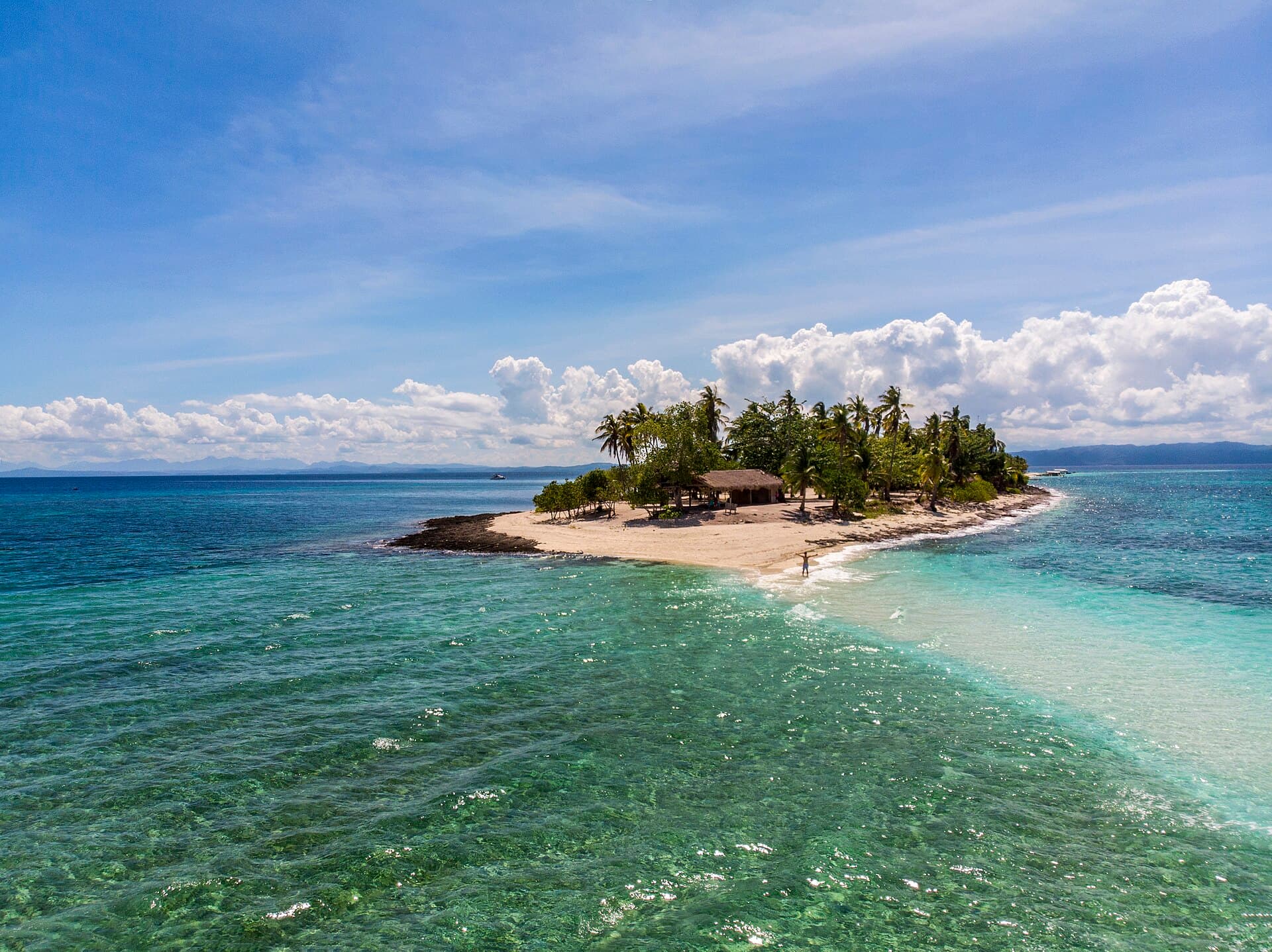
Kalanggaman Island
A sandbar between two islands that has banned your shampoo.
Kalanggaman is a sandbar in the sea between Leyte and Cebu, named from the local word langgam, which means bird. Two of the four Philippines lists we read name it. You register and book a boat at the Eco-Tourism Office in Palompon, and the crossing takes about an hour; a self-organised visit needs a reservation on the booking portal before the tour date. The local government provides restrooms, grilling stations and cottages. The environmental fee is around PHP 150 for day visitors. Soap, shampoo and detergent are strictly prohibited. Wikipedia gives its length as 753 metres; we measured 789.
Best: May and June (30.7 °C), then July →
Philippines · Calaguas Islands
No. 5
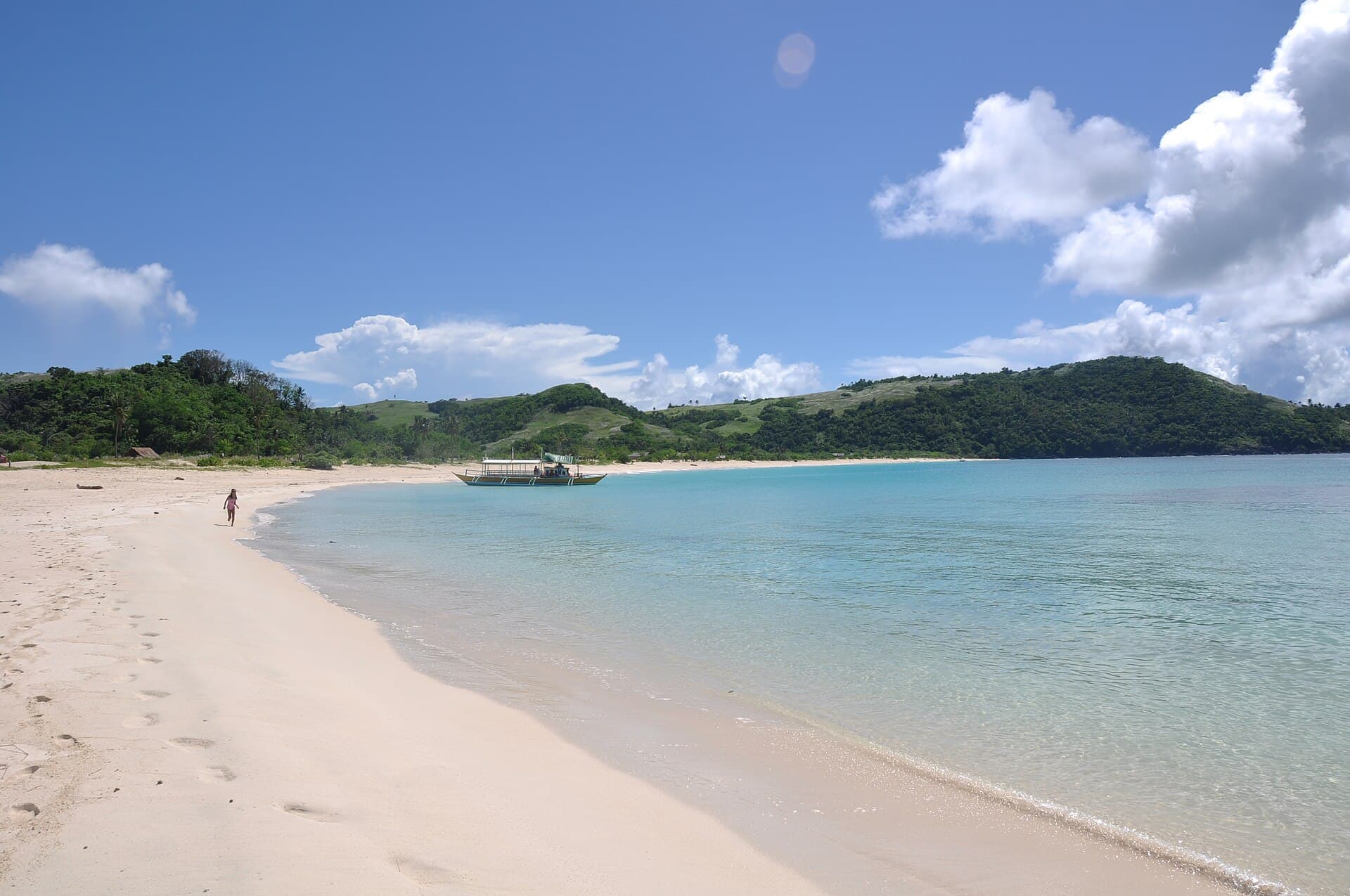
Mahabang Buhangin
Fourteen hours from Manila, no signal, and the widest sand on our list.
Mahabang Buhangin, in the Calaguas Islands, is the widest of our ten Philippine beaches: 76 metres of sand on average. Getting there from Manila takes about 14 hours of zigzagging bus routes and long boat rides. There is no phone signal and no ATM, so bring cash. From July to December, typhoon season often brings rough seas and cancelled boats. Rough Guides calls it pretty secluded. We measured 1,085 metres.
Best: June (30.6 °C), then July and August →
Philippines · Boracay
No. 9
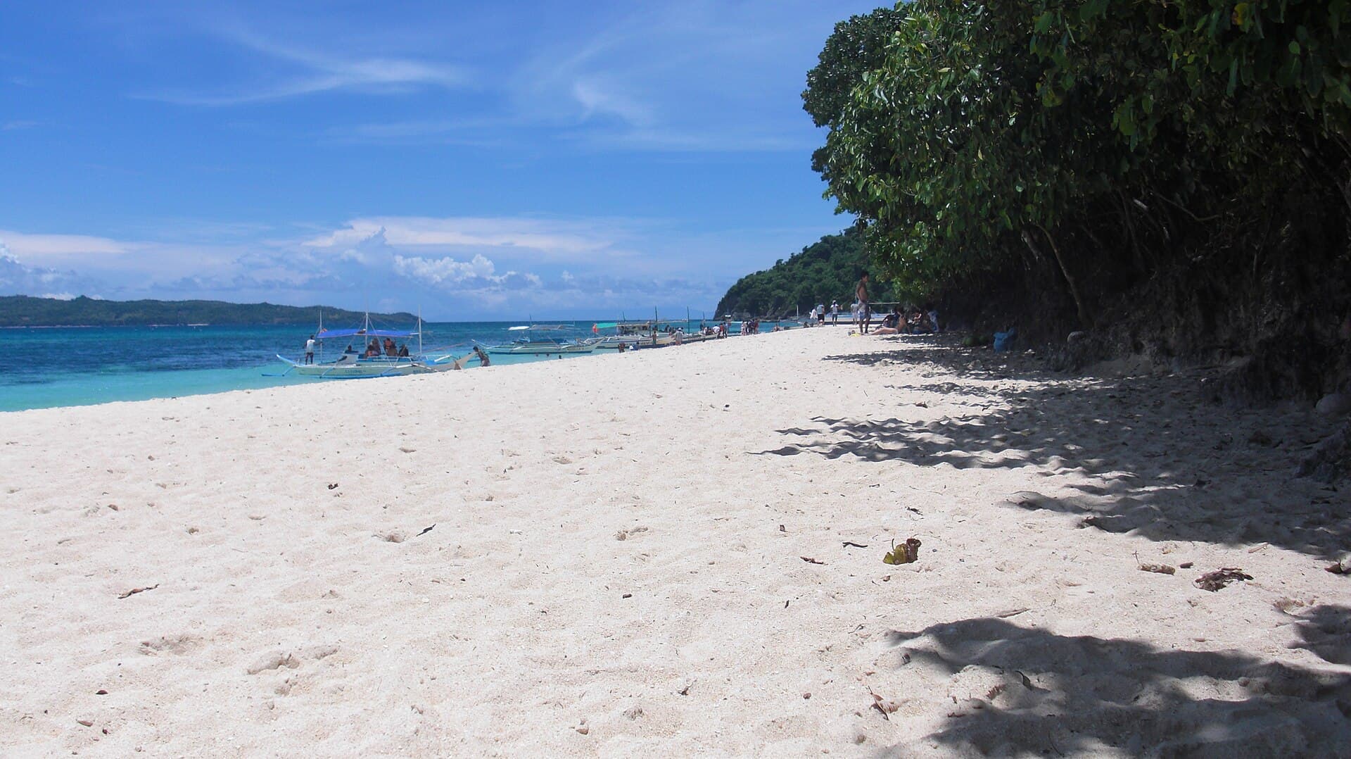
Puka Beach
Boracay's quiet end, where the island's jewellery comes from.
Puka Beach is a quiet stretch of white sand at the northern tip of Boracay, and the place where locals gather the small puka shells used in jewellery sold on the island. The sand is coarser than White Beach's, and the beach is relatively empty. A tricycle back to D'Mall should cost around ₱40. We measured 1,118 metres.
Best: May (30.5 °C), then June and July →
No photo we can show yet
Australia · Kangaroo Island, South Australia
No. 10
Stokes Bay
The front door is a maze of caves. The reward is an empty beach.
To reach Stokes Bay, Time Out says, you crawl through a maze of caves. It is on the north coast of Kangaroo Island, a 40-minute drive from Kingscote, the largest of a run of coves along that shore. There is a toilet block and a café near the car park. Lonely Planet says to time your visit for low tide and keep an eye on the sea. Time Out calls it free from crowds. We measured 490 metres; Lonely Planet says 500.
Best: February (21.8 °C), then January and March →