Pasjača
ONLY IF YOU'RE ALREADY THERE

Croatia · Konavle · #7 of Croatia's ten by fame

Pasjača

Made from the rubble of a tunnel, thrown off a 200-metre cliff. Check the path before you go.

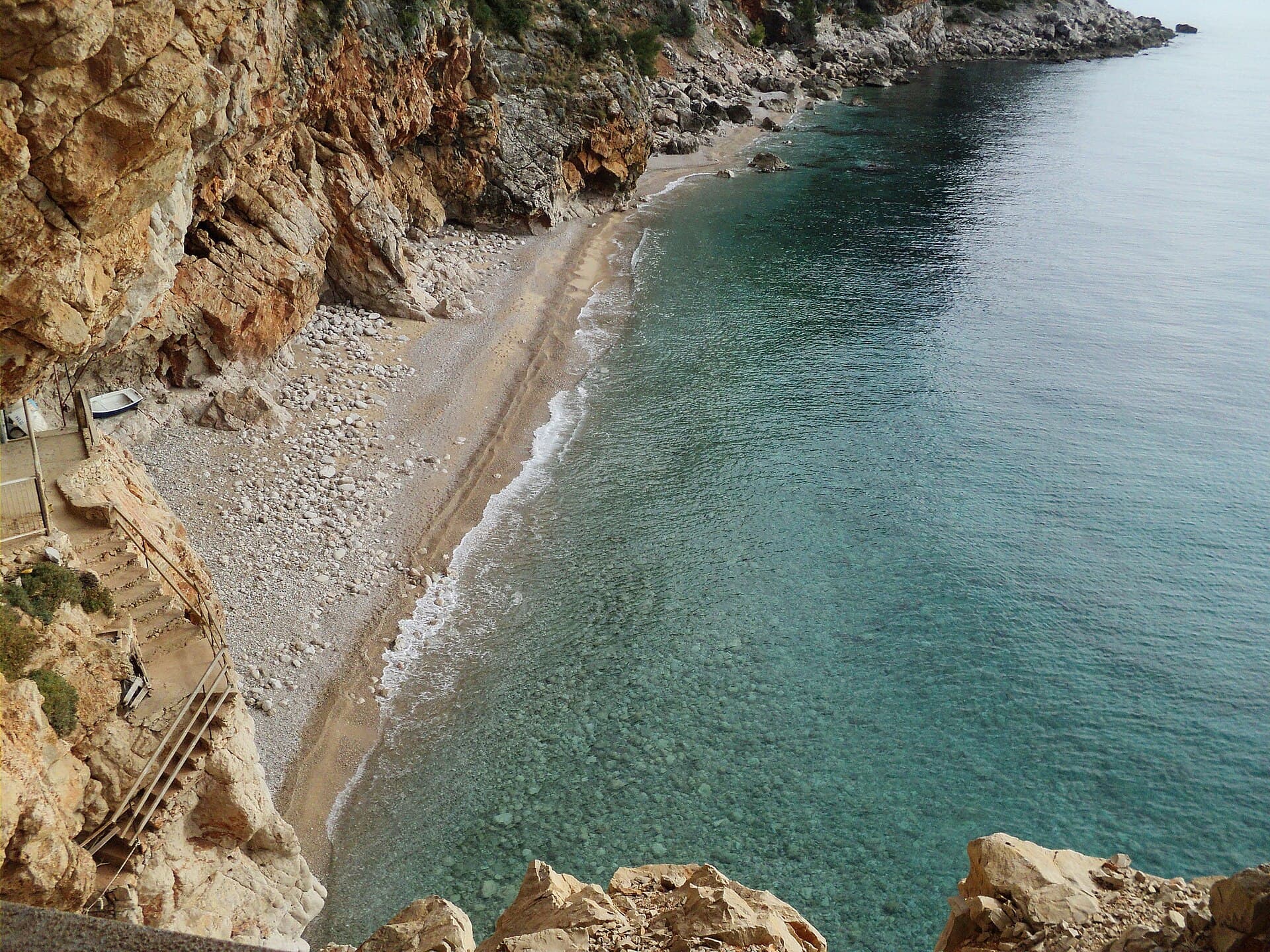
How we rated it: up one for a sourced find (a beach made from a drainage tunnel's rubble), down one because a rockfall in April 2025 buried the path down, leaving the beach reachable only by sea. Photo: MEETCROATIA_NET · CC BY 3.0

The hang

Pasjača exists because of a drainage tunnel: in the middle of the last century, the earth and stone dug out to drain the Konavle fields were thrown into the sea from the edge of a 200-metre cliff, and the waves turned them into a beach. In April 2025 a large rockfall buried the path down, and a regional paper reported the beach could be reached only by sea; a July 2026 article still advises checking whether the path is passable before you go. It is 40 minutes' drive south of Dubrovnik, at the village of Popovići, where an asphalt road from Cavtat ends in parking for about 50 cars. The way down is a steep, narrow, winding path and a small tunnel carved through the rock. Nothing is provided: bring water, a towel and a roll-up mat. Its remoteness keeps it quieter than most beaches nearby. We measured 91 metres; Wikipedia says 80.
The real intel

Best months · warmest sea
July and August (26.0 °C each), then September. Coolest: February (15.4 °C). One year of data, 2025.
Best months · emptiest
No crowd data by month. It is quieter than most beaches in the area.
Getting there
About 40 minutes' drive south of Dubrovnik to Popovići; parking for up to 50 cars.
The catch nobody tells you
A rockfall buried the path in April 2025; check it is passable before you go. Even open, it is steep and narrow, through a rock tunnel, and not suited to elderly or disabled visitors or families with small children.

The year at Pasjača

Warmest sea in July and August. Fewest wet days in June. Pick your fight.

J
F
M
A
M
J
J
A
S
O
N
D
Sea (°C)
16.1
15.4
15.7
16.5
19.6
23.8
26
26
25.2
20.5
18.9
17.2
Air (°C)
10.4
9.1
12.2
14.4
17.2
24.9
26
25.5
21.9
15.5
12.9
10.6
Sun (h/day)
5.8
7
7.2
10.7
12.1
14.3
13.8
12.8
10.8
8.3
6
7.1
Rain (days)
16
9
18
13
15
0
6
8
7
14
18
7

One year of data, 2025, from Open-Meteo at this beach's coordinates. A rain day is 1 mm or more. The red bar is the month to aim for in each row.


The crowd

Quieter than its neighbours, because of the walk.


The facts · we measured

Length
91 m
Mean width
14.9 m
Area
1,354 m²
Warmest sea (2025)
26.0 °C in Jul
Coldest sea (2025)
15.4 °C in Feb
Sea by month, °C
Jan 16.1 · Feb 15.4 · Mar 15.7 · Apr 16.5 · May 19.6 · Jun 23.8 · Jul 26.0 · Aug 26.0 · Sep 25.2 · Oct 20.5 · Nov 18.9 · Dec 17.2

Questions people ask

How was Pasjača beach formed?

Earth and stone dug out to drain the Konavle fields, including a drainage tunnel finished in 1958, were thrown off the 200-metre cliff, and the waves turned them into a beach.

Is Pasjača beach open?

A rockfall buried the path down in April 2025, leaving the beach reachable only by sea. A July 2026 article advises checking whether the path is passable before you go.

How do you get to Pasjača?

Drive about 40 minutes south of Dubrovnik to Popovići, park, and walk down a steep, narrow path through a small rock tunnel.